 |
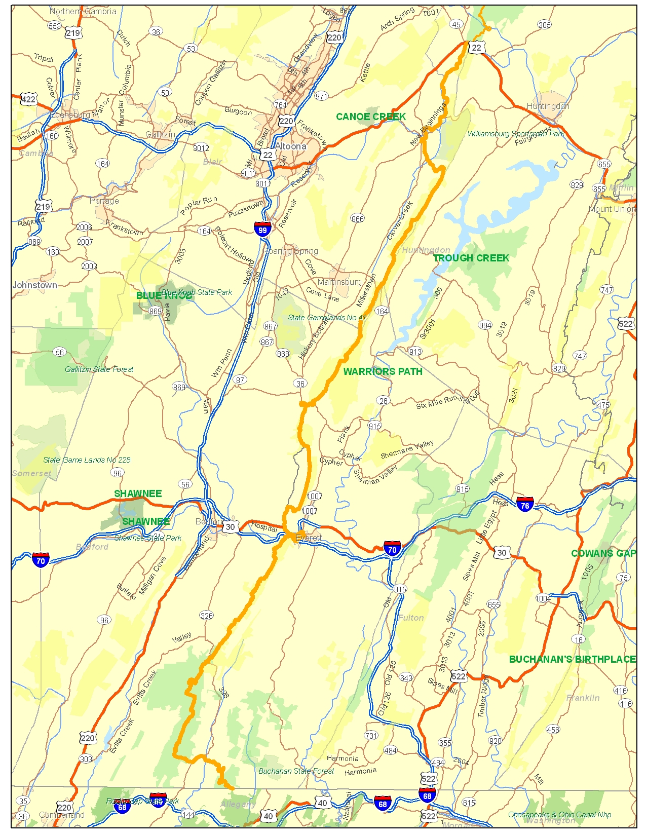
The highest knob, the sharpest ridgelines, and some of the most dramatic views on Mid State Trail await intrepid hikers in the Everett Region.
Click for Everett Region Hiking Maps
Started in 1994 by volunteers of Keystone Trails Association Trail Crew, and opened continuously throughout in 2001, the southern end of MST offers significant challenge and reward to the hiker seeking quiet enjoyment of wild ridgelines.
MST passes Buchanan State Forest, State Game Land (SGL) No. 97, SGL 73, SGL 118, and Lower Trail, through Bedford, Blair, and Huntingdon Counties, and the Boroughs of Everett and Williamsburg.
Active reconstruction is underway to move MST away from Snake Spring Valley Road northwest of Everett, onto scenic Tussey Ridge, through private land and isolated sections of SGL 73. The first section of this new relocation opened in November 2005.
Click for Trail Alerts and Guide Updates
A new bridge is projected to cross the famous trout stream of Yellow Creek near Loysburg.
Debra Dunkle, Everett Regional Manager, can be reached at dhdunkle AT embarqmail.com or 814 652-2227.